Circular Hike: Salève: Ascent with “The Grand Gorge” trail and descent on “Pas de l’Échelle” trail
From almost all vantage points of the City of Geneva, the cliff of Mount Salève is an un-mistakable fixture. On a bright sunny day, a visit to Geneva should include a visit to France, more precisely the top of Salève, let alone through the cable car that breezes visitors to the top in less than 10 minutes, even better a circular hike from the Swiss border!
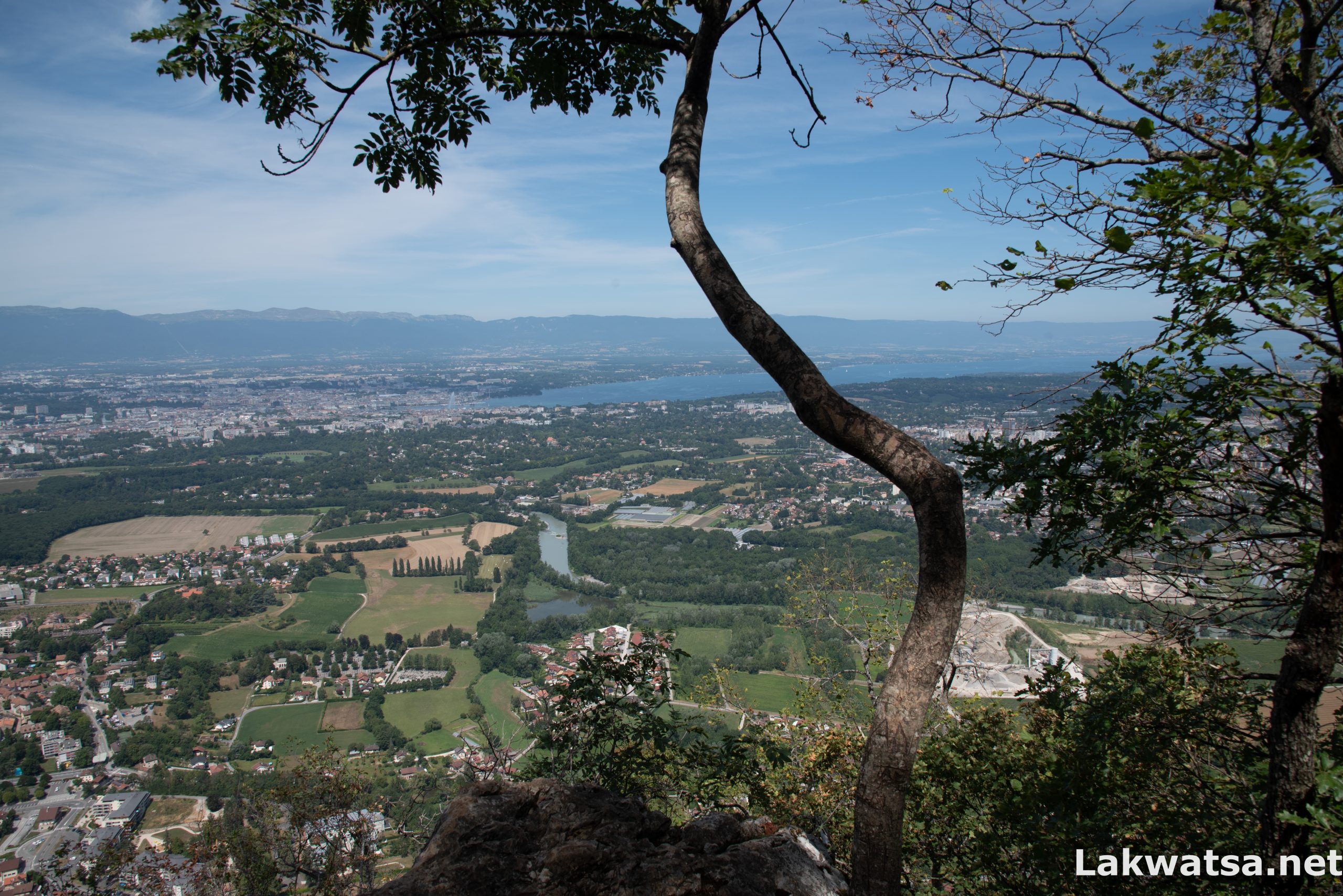
On a sunny day, Salève, the balcony of Geneva, earns its Monicker by providing a beautiful view of the city, the lake, the Jura mountains, the Arve, and the Rhone river, which undulates like a serpent down the Geneva countryside. 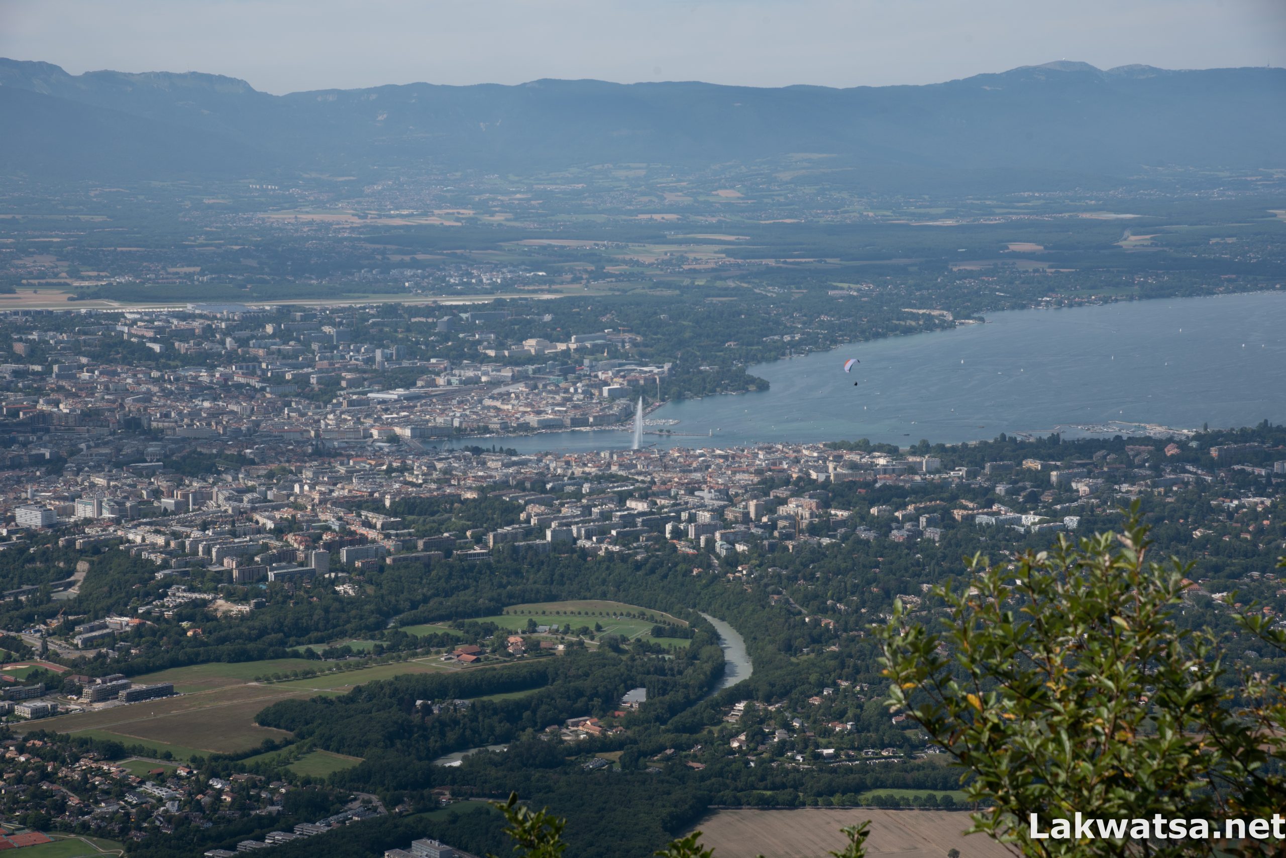
As I am writing this post in the time of Covid-19, the border is, unfortunately, closed for matters of leisure. But soon, this will be a distant memory, and it will once again be an absurd line, delineating the same region tourism-wise.
Winter, Spring, Summer, and Fall all reserve the viewer something different to appreciate, like the sunflowers of summer or the red-tinted leaves of Autumn, the different shades of flowers that blossom in Spring, even Winter brings its charm with its snow-clad fields.
Fortunately, you can hike both the “Pas-d’échelle” and “Grande Gorge” trails in all seasons. Though, you should reserve much precaution on Winter, where spikes are necessary because of glacial paths. For Winter, I recommend that you do this Hike with people who know the terrain like the Geneva Association of the friends of Salève (Association Genevoise des Amis du Salève – AGAS). Every Sunday at 10:05 am, they organize free guided Hikes of Salève, starting from the Veyrier-Douane bus stop in Switzerland.
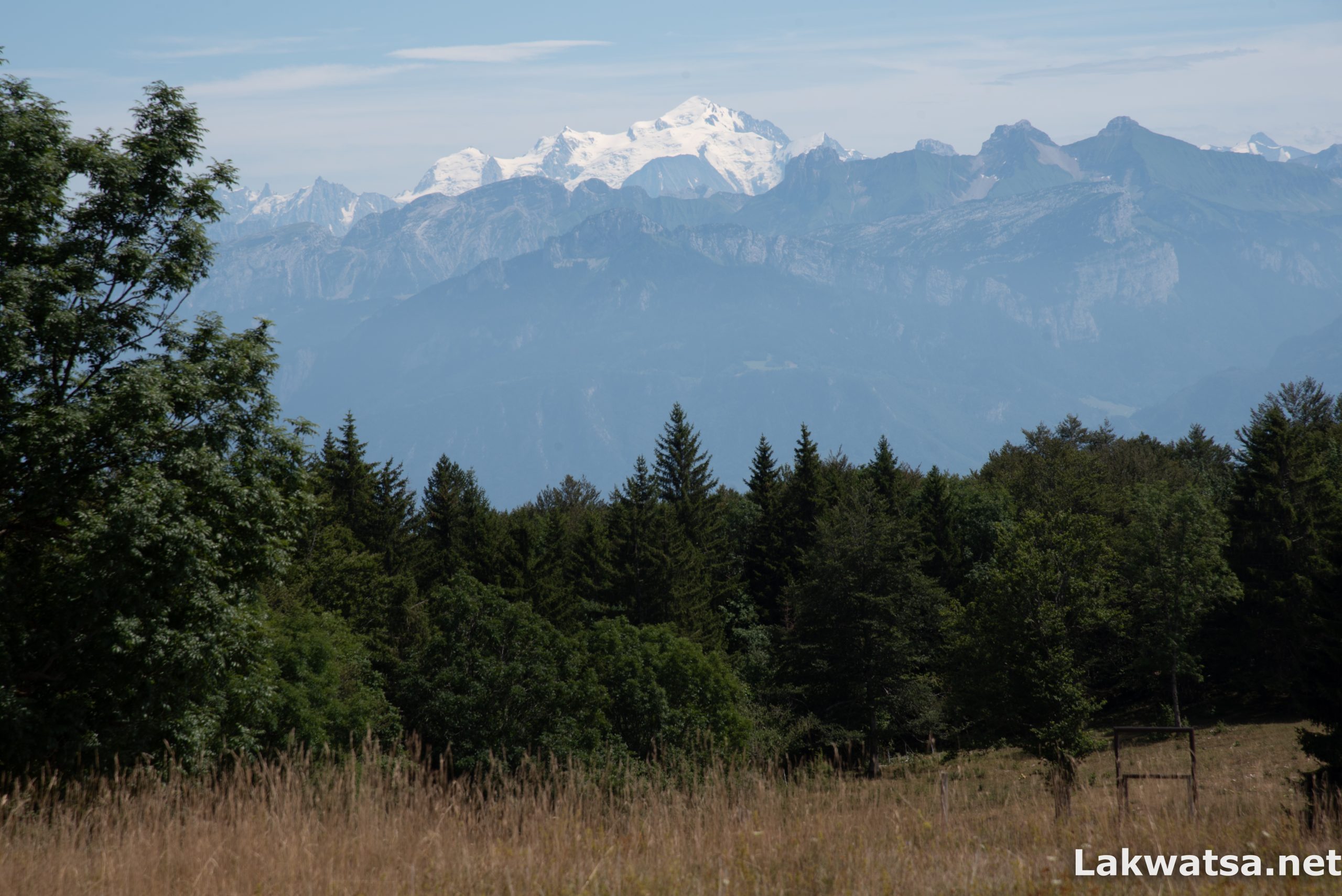
From the top, if you look South on a sunny day, get ready for a majestic view of the Mont Blanc.
Getting there by public transport from Geneva
Take Bus 8 with a destination that says Veyrier-Douane. The bus brings you to the Swiss side of the border of Veyrier. From there, cross the border to France and look for the Cable car station if you want to use it for your ascent, otherwise signs are available for the Pas de l’échelle and Grande Gorges trails, however, I find it easier to use GPS navigation with GPX tracks(See Trip Summary below)
The path starts on the wooded face of the mountain, and it follows its slopes toward the bottom of the Grande Gorge, and further up southwest, you’ll reach the Summit of Salève. This trail takes around 3 hours and a half to climb. 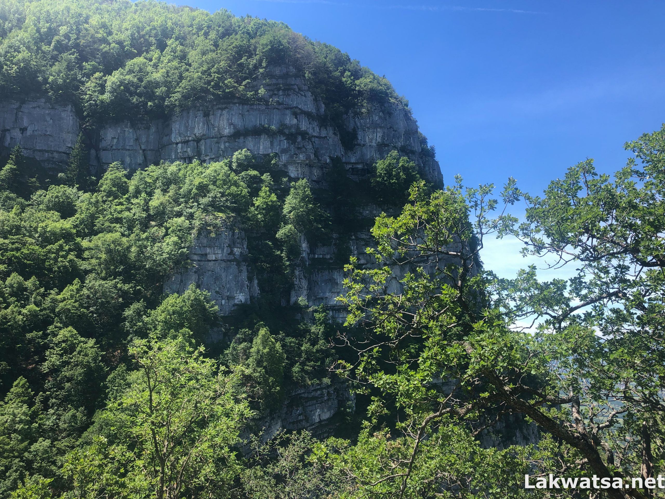
I count at least two restaurants around the summit, not to mention a little shop by the cable car station for coffee, sandwiches, and drinks. On long hikes like this circular Hike, you should bring an ample amount of food and water with you. I usually bring between 2 to 3 liters of water on this Hike. I would qualify these trails as steep, especially the “Grande Gorge,” and would classify this as a Medium Hike or a T2-T3 grade using the Swiss scale
.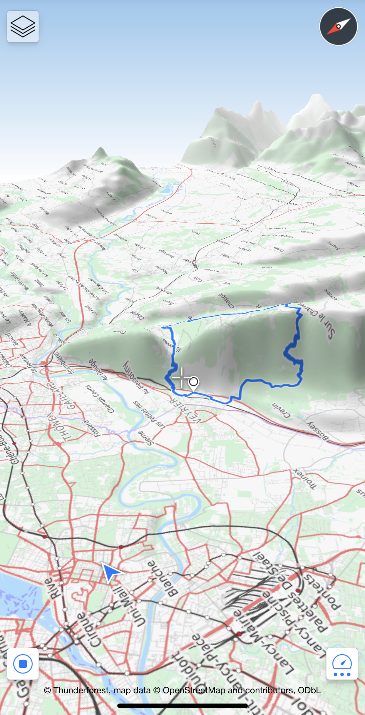
The Pas-d’echelle, the more straightforward path of the two, starts near the top of the Cable-car station, which is around 30 minutes walk from the Summit. The walk down to the border will take around an hour and a half.